Thursday, September 27, 2007

Placing High Definition Photos

One of my favorite aspects of the new photo feature in Google Earth version 4.2 is that it allows you to view high resolution photos from the exact point where the photo was taken.

A great example of this is the Gigapan photo of Half Dome in Yosemite. To view this example, in the Layers panel, check Featured Content > Gigapan Photos. Navigate to Yosemite National Park and enter the photo of Half Dome (learn more).

Note that the placement of this exceptional photo matches and aligns with the terrain and base imagery of Yosemite. You can place your own high resolution images in Google Earth and set the viewer's perspective using either Google Earth or KML's PhotoOverlay tag.

Monday, September 24, 2007

Live Traffic

As with Google Maps, in certain areas, you can view live traffic conditions in Google Earth. To enable this, first navigate to the appropriate location. In the Layers panel, check Traffic. Traffic conditions are denoted by colored dotted lines (green = all clear, yellow = slowish, red = call in to tell them you'll be late, gray = no info available).

You can click each colored icon and see how fast traffic is moving at that location.

As you zoom in, areas with available traffic information appear with a traffic icon:


Friday, September 21, 2007

Preview Layer

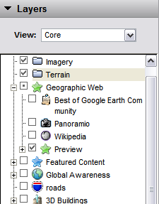
You may have noticed the new Preview layer in Google Earth (Geographic Web > Preview). This layer shows you a sample of premium content from other layers, but reduces the number of points of interest so that your view remains uncluttered and easy to explore.

It is a great way to become familiar with available Layer content. And if you like what you see, just click Show this layer in the appropriate balloon. For example, if you learn that you enjoy samples from the American Institute of Architects (AIA), you can view all available content by the AIA. Similarly, you can click Hide this layer to hide AIA icons.

Learn more about using layers.

Wednesday, September 12, 2007

Flash in Google Earth

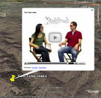
Google Earth Version 4.2 supports Flash animations in placemark balloons. This means you can embed Flash movies, interactive games, demos or any other Flash content in a balloon. Frank Taylor of gearthblog.com mentions one cool implementation of this new feature. I look forward to seeing what other creative uses the Google Earth community makes of this functionality.

Please note that at this time, this feature is only supported on Windows.

Thursday, September 06, 2007

KML and Photos

As previously mentioned, Google Earth version 4.2 allows you to add and navigate high definition photos. As with other content in Google Earth, these photos are specified in KML. In this case, the important KML tag is PhotoOverlay. According to the KML documentation:
The PhotoOverlay element allows you to geographically locate a photograph on the Earth and to specify the placement and orientation of the Camera that views this PhotoOverlay. The PhotoOverlay can be a simple 2D rectangle, a partial or full cylinder, or a sphere (for spherical panoramas). The ImagePyramid child element of PhotoOverlay provides for efficient handling of arbitrarily large photographs in Google Earth.
Read more about using KML and photos.