Monday, June 30, 2008

Tour Tips

When you create a tour, try the following tips to create a great tour experience:

Before you record your tour or present it to others, run the tour on a loop again and again. This will cache the imagery and provide a higher quality tour.

Consider how fast you want the tour to proceed. Is the Earth imagery more important or does content that appears in placemark balloons need more emphasis? You can set how fast the tour plays, how fast it flies to each destination and how long the tour pauses at each placemark. Learn more.

Set your tour to follow an invisible path (see this earlier posting).

Friday, June 27, 2008

Emergencies in Google Earth and Maps

Public agencies and NGOs have learned to use Google Earth/Maps and KML to create incredibly useful presentations about disasters, even as these emergencies are unfolding. Here are some examples:

Northern California fires - Created by the California Governor's office of Emergency Management, this map has been invaluable for those of us who live near these areas.

Myanmar Cyclone - This KML shows the impact of the original Nargis storm, including the enormous scale of flooding caused by the disaster.

USGS Earthquake Monitoring - This depicts significant earthquake activity in the past seven days. From the placemark balloons, you can also access historical earthquake information.

Google publishes great related information that you can access in the Layers panel, such as the Weather, Gallery > Volcanoes/Nasa and Gallery > Wikipedia. I find these visual depictions to be so much more meaningful that media reports that merely talk about the impact of these disasters. With dynamic mapping tools, you can see exactly where the emergencies occurred and what regions are affected.

Tuesday, June 24, 2008

KML Samples in Maps

Curious how KML elements appear in Google Maps? Take a look at this sample file. Check any item to display it or click a link to zoom in. Google Maps supports a subset of KML features, as described in the KML documentation. Of course, you can view a KML sample in Earth as well.

Although I have not tried it, this site claims to preview your KML on Google Maps, which is certainly easier than tweaking you code, uploading your KML to a server and reloading it with each change you make.

Thursday, June 19, 2008

All About Context

Michael Jones discusses geographical context and Google's objectives in this fascinating presentation:


Tuesday, June 17, 2008

Preserving with Google Earth

On Friday, I presented to the Northern Region Council of Land Trusts in Fortuna, California. The subject was using Google Earth and Maps as tools for land conservation. The work of local land trusts is very important, as they work cooperatively with the entire community to preserve open space, create trails and simply make our communities better places to live. Land trusts often operate on a shoestring budgets and rely on the honorable efforts of volunteers.

I've long thought that Google Earth and Maps represent great tools for these organizations. With little technical know-how or money, they can use these products to mark locations and parcels important to conservation campaigns and share them with the public. It can be difficult for land trusts to convince the public or government that a particular area is worth preserving, particularly if the land in question is in an obscure or remote location. Google Earth removes these limitations; you can fly people to any location and show off its unique qualities. Once again, it is all about geographical context.

Wednesday, June 11, 2008

Outreach Showcase

Want to see some very inspiring, imaginative presentations in Google Earth? Look no further than the Google Earth Outreach Showcase. The KML on these pages are created by people who are literally trying to change the world by raising awareness of important global and local issues.

Close to my home, I am particularly fond of the California's Marine Protected Areas KML, which makes clever use of polylines, image overlays and attractive HTML placemark balloons to describe the beauty and importance of these coastal areas within a geographical context.

Monday, June 09, 2008

Navigating in Version 4.3

I am not sure how I managed to forget to mention this, but in April, I created a video that covers some the new navigation features in Version 4.3.

Thursday, June 05, 2008

Google Earth API

The Google Earth browser Plug-in supports a JavaScript API that allows you to manipulate camera angles, open balloons, add 3D models, draw KML, toggle to Sky mode and much more.

To see first hand what it can do and view some sample code, check out this sample page. For beta documentation, take a look at the developer guide. For additional help, visit the Google Earth Plug-in help group.

Tuesday, June 03, 2008

Labels and Layers

As in real life, navigating in Google Earth is easier if you have some physical reference points. Some of these are obvious and popular, such as the road, borders and labels layers. In addition, you can orient yourself by using Places of Interest layers. Within this folder, I find the following very useful:

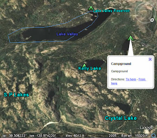
Geographic Features - I spend a lot of time hiking and biking and this folder shows great information (bodies of water, mountain peaks, etc.) in areas that have fewer roads. Plus, you can check out historic seismic activity around the world, courtesy of the USGS.

Parks and Recreation Areas - Again, my bias towards the great outdoors is in effect here. But this information is fantastic. Camping spots, trail routes, wildlife refuges, ranger stations and more. The USFS boundaries can help you work with traditional topographical maps to find your way.

Of course, you may need to zoom in a bit to see some of these points of interest in the 3D viewer.