Friday, March 30, 2007

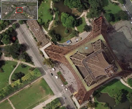
So When Will My House Stop Being Blurry?

Once I mention that I am on the Google Earth team, I frequently hear from people:

"Why is (area x) blurry? When will this be updated with better imagery?"

There is no one answer to these questions. Here is what the Google Earth Support Center says:

"We update our imagery regularly and strive to do so as often as possible. However, we're unable to provide you with specific information regarding when a specific area will be updated. Also, we don't offer high resolution imagery by order. This information will be added when it's available from our data providers.

A great way to stay informed is through The Sightseer, our monthly newsletter, which highlights all of our data additions on an ongoing basis. If you'd like to subscribe, please visit
http://earth.google.com/sightseer_signup.html"

and:

"Google Earth acquires the best imagery available, most of which is approximately one to three years old."

Still, most people want to know exactly when future high resolution imagery will become available. I can tell you that Googlers constantly work to update our Maps and Earth product imagery. It is a big challenge to provide the best possible imagery for the entire globe. Having said that, Google does a fantastic job and issues frequent updates to imagery. So it pays to follow the suggestion of subscribing to the Sightseer; it is a great resource.

Wednesday, March 28, 2007

Using the Time Slider

When you select items in the Places panel that include time-related data, the time slider appears. This tool allows you to display or play information in a visual time sequence.

Users have created some very clever implementations that make terrific use of this feature. For example, one user created a KML-based visualization of how the London skyline has changed over the years. Once you download this file, you can select and check it in the Places panel and move the time slider so as to see what buildings were constructed when. Very cool. Read more about this on Google Earth Blog.

Do you have a favorite implementation of the time slider feature? Learn more about using the Time slider.

Wednesday, March 21, 2007

Placing Custom Aerial Photography

This morning I had some fun with an aerial photograph taken by a colleague here at Google. She shared one of her excellent photographs which depicts the coastline of Santa Cruz, CA as seen from the cockpit of a small plane. I placed the image as an overlay in Google Earth, but as this image was not of the landscape at a 0 degree tilt (i.e. looking straight down), I had tweak and stretch the image a bit to place it. Additionally, I used the Snapshot View command to capture an appropriate view point in Google Earth.

I posted this as a KML file so that everyone could take a look. Let me know what you think.

I was only somewhat successful, as the overlay is not an exact match to ground features. Notice the roads and some other features are not aligned. Anyone else want to open this file and edit the overlay yourself? It is tricky, but very fun!

Monday, March 19, 2007

Overview Map

Google Earth can display an overview map that helps orient you by showing the location of current view in the context of a larger geographical area. The center of the area currently displayed in the 3D viewer is show as a red cross or box in the overview map.

To show or hide the Overview Map window, do one of the following:
  • Click View > Overview Map
  • Click CTRL (Command/Open Apple Key on the Mac) + M
Learn more about using the overview map.

Thursday, March 15, 2007

Creating Overlays for Google Maps

You may know about adding image overlays in Google Earth. But did you know that you can publish these overlays in Google Maps and share them with others?

Example: I took a portion of a map of the Stevens Creek Trail here in Mountain View, CA and added it as an image overlay in Google Earth. I then saved the overlay as KML (right click the overlay in the Places panel > Save As). I posted this KML file on a website. Next, I went to Google Maps, typed in the URL of the KML and clicked Search Maps. In the resulting page, I clicked Link to this page and copied the the URL. View the Steven Creek Trail in Google Maps.

Here is another example showing an image of Mount Etna.

Note that any image overlay added to the Google Earth Community boards can be viewed in Google Maps by using the link at the top of the posting.

Tuesday, March 13, 2007

Posting KML on a Web Server

If you wish to post a KML file on web server to share it with others, there are several things to keep in mind.

First, for users to open these files in Google Earth, you need to add MIME types to the server. These are:
  • application/vnd.google-earth.kml+xml kml
  • application/vnd.google-earth.kmz kmz
Of course, you can simply post your KML on the Google Earth Community boards and not worry about MIME types :-)

Next, consider using network links. These are KML files which automatically refresh content as it changes on the server. With a network link, users do not need to download the latest version of your KML each time its content changes. This works great for dynamic KML data. Learn more.

Lastly, users can also view a limited set of KML content in Google Maps if the KML file is already on a web server. Just go to maps.google.com, type in the URL of the KML file and click Search Maps. In the resulting page, click Link to this page, copy the URL and share it the world. Here is an example of a KML file as shown in Google Maps; it represents a hike in Colorado.

Monday, March 05, 2007

Printing Driving Directions

Google Earth has a nifty feature for printing driving directions. Once you have created directions and print them, these printed directions appear with intersection thumbnail images. In other words, not only can Google Earth tell you how to get somewhere, it shows you pictures of intersections where you need to turn or merge on the way. Click the image on the left to see an example.

To use this feature in Google Earth, generate some driving directions, then click Print > Driving Directions > Print. Learn more about printing.

Thursday, March 01, 2007

Google Earth Groups

Google recently launched a new set of groups: Google Earth Help. These replace the Google Earth Community help forums, which are now read-only. Forums in the new group include:
  • Google Earth
  • Google Earth Plus
  • Google Earth Pro
  • Google Earth for Mac OS X
  • Google Earth for Linux
  • Google Earth Pro Movie Maker
Chances are that if you have a question about using Google Earth, a peer or Google employee can answer it on these boards. Give it a spin and tell us what you think.

Word is that soon another forum will begin that I will closely watch: Google Earth GPS :-)