Thursday, December 11, 2008

What About Real Time Imagery?

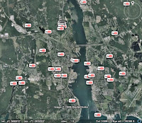
The most common question that the Google Earth team receives is "is the imagery in real time?" The simple answer is "no." The better answer is why it can't be.

A common misconception is that Google collects and owns this imagery. In actuality, we acquire this imagery from many different data providers, including TeleAtlas. These companies are the ones that own the satellites, collect the imagery, and offer it to the world. For Google Earth, we take the best imagery we can find from these providers and we piece it together on the 3D globe. As you can imagine, this entire process of getting a satellite into space, having it take pictures, getting those pictures back to Earth, reviewed, and placed into Google Earth can take some time. We want to make sure that we're providing you with quality imagery, so we do a lot of checking on the data.

Additionally, you'll find that we may have new imagery in some areas, and older imagery in areas right next to it. We do this because this older image is of a higher resolution or better quality than the newer image we have available. We're working on making the process better, and we've teamed up with GeoEye to get imagery from their new Geo-Eye 1 satellite, which will be taking high-resolution photographs of large portions of the Earth's surface.

Will this lead to real-time imagery? Probably not any time in the near future. To do that, we'd need hundreds, if not thousands of satellites all running 24 hours a day to capture imagery. What if you need more recent imagery than what's available in Google Earth? If that's the case, we recommend that you zoom in on the area you're interested in, and look at the copyright information displayed in the bottom of the Google Earth window. You can then contact the data provider listed by visiting their website and see if they have more recent imagery available.

Tuesday, December 02, 2008

Check Out the User Groups

The Earth Help Group is a valuable resource for you to search for Earth related answers provided by other users, to post a question you need assistance with, or to discuss your support questions.

In addition to other users, there are two kinds of experts in the these groups that can help you. Earth Rangers are Google employees and can be identified by the badge. Earth Experts are volunteers who share their considerable product knowledge with other Groups users. Both are terrific resources and really know their stuff.

Not sure how to begin? Please look at other resources displayed in the Welcome Message before you post!

Wednesday, November 19, 2008

Geotagging iPhone Photos

With the debut of of iPhone 2.0 software, you can enable the Camera app to geotag your photos on the iPhone 3G. To enable this on your iPhone, click the Settings icon > General > Location Services.

Once you've done this, all photos you take on the iPhone are assigned a location. You can then upload these photos to Picasa and then port them over to Google Earth using the geotagging feature of Picasa.

This saves you the step of manually geotagging your pictures. Plus, your family will be hugely impressed when you show them photo albums in Google Earth :-)

Looking at the Source

At anytime, you can view the KML source of items in the Places panel. To do this, select the item and click Edit > Copy. In a text editor, click Edit > Paste. The KML source appears in the new document.

Personally, I use this method to examine the source of Places data I've come across that show content in an interesting way. You can also examine the source of Layers content by right clicking (CTRL + click on the Mac) a point of interest in the 3D viewer, saving it to My Places and then use the method described above.

Thursday, October 30, 2008

Timeline Tutorial

Richard Treves is the author of kokae.com and blogs about the usability of Google Earth projects at Google Earth Design.

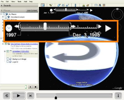
Recently, he created a very interesting timeline tutorial video that describes how to use the time slider in Google Earth. This particular post also provides a reasonable critique of this feature.

The time slider displays content in Google Earth along a sequence of time. Check out Frank Taylor's examples of time animations on gearthblog.com.

Learn more about using the time slider.

Friday, October 24, 2008

Creating Dynamic Views in Movie Maker

If you're making a movie in Google Earth, you might want to change the camera angle or altitude to change as you fly over different places. The best way to do this is to use placemarks, rather than a single path.

If you choose to have your movie follow a path, your camera angle and altitude will remain the constant along that path. When you create a placemark, you can create specific 'View' settings that affect the way it will appear in your movie. Mouse over each field in the 'View' tab for explanations of each term, or click Snapshot current view to apply your current view settings to that placemark.

In this way, you can make a more compelling movie that shows dynamic views.

Learn more about making movies.

Wednesday, October 22, 2008

KML Interactive Sampler

I am very excited by the recently-published KML Interactive Sampler (read the announcement). Using the Google Earth plugin, it allows you to test sample KML and see this content immediately in Google Earth. You can also play with your own KML. For example, you can copy and paste KML into the main field, click Update Earth and instantly see how your code will appear to end users.

For now, you'll need Windows to use this tool, as the Google Earth plugin is currently only supported on this platform. Rest assured that a soon-to-be-released Mac version is in the works.

Learn more about using KML.

Friday, October 17, 2008

Navigating and Embedding Photos

As Google has recently published new imagery in Street View, knowing how to navigate photos becomes even more useful. You can navigate high resolution imagery in the following layers:

Street View
Gallery > GigaPxl Photos
Gallery > GigaPan

To view this imagery, enable any of these layers and navigate to the appropriate location. Click an icon to enter the photo. Remember that you can move around within each photo by clicking or dragging the image. Learn more about navigating photos.


View Larger Map
spacer
You can embed your own custom Street View on your website using Google Maps. This is both easy and very cool (see example at left).

To do this, go to Google Maps and navigate to your favorite Street View. Click Link to this page, copy the web address from the Paste HTML to embed in website field in your browser and paste it into the HTML code of your website. To resize and preview the map, click Customize and preview embedded map.

Thursday, October 02, 2008

Searching for Planets

This functionality was not available when Sky launched, but now you can search for planets in our own solar system. For example, if you search for Mars, Sky shows you the planet at its approximate location at the time shown.

To do this, in the Search panel, click Search the Sky, enter the appropriate planet name and click the Search button.

Learn more about using Sky in the Google Earth user guide.

Thursday, September 25, 2008

Purple Buildings

Did you know that you can view additional information about many of the 3D models available Google Earth (Layers > 3D Buildings)?

Mouse over certain buildings and they appear purple. Click these buildings to view additional information from the 3D Warehouse.

Wednesday, September 17, 2008

Creating Navigation Buttons in KML

I just published the following video to the Google Developer Channel:

Monday, September 08, 2008

Italian 3D Models

Antonino G is a gifted Italian 3D modeler who has a fondness for historical Europeans buildings. If you are new to 3D models in Google Earth, be sure to check out his 3D warehouse collection.

Antonino has also modeled exceptional modern architecture as well, such as the Stadio San Filippo di Messina. Personally, I love the Castello di Milazzo model he created. Antonino has also gathered a collection of buildings in Sicily, which seems to have more than its share of great models.

Antonino's work is also featured in My Favorite Thumbnails collection, which provides modelers great examples of thumbnail images used to preview individual models in the 3D Warehouse.

Tuesday, August 26, 2008

Map Your Own Theme

I've been playing with the Thematic Mapping Engine, which is a web-based tool that allows you to generate visually compelling KML based on statics such as those available at UNdata. The less tech savy will be excited to note that this tool requires no coding skills whatsoever. So go ahead and impress your friends. Or check out these examples.

The resulting presentations are pretty darned nifty and you can control many aspects of how this information is displayed in both Google Earth and the Google Earth browser plugin.

Wednesday, August 20, 2008

Geothermal Presentation

Google.org launched some incredible KML recently that describes potential geothermal energy resources in the United States. This presentation utilizes the Google Chart API. Read about this effort or view this presentation in Google Earth.

This KML is both very slick and very effective. Be sure to play with the settings in the Places panel to see 3D depictions, energy resource depth and animations. Each chart icon opens a placemark balloon that provides additional information about geothermal resources in the given state.

Tuesday, August 19, 2008

Imagery Dates

I am not sure why, but it seems that many Google Earth users are not aware that you can determine approximate imagery dates in version 4.3. Perhaps the other 4.3 features such as sunlight overshadowed (har har) this feature.

From the user guide: "Google Earth displays the approximate date of displayed imagery in the status bar at the bottom in the 3D viewer. As you mouse over a location, this information depicts the date of the imagery. Note that this date is only approximate."

Thursday, August 14, 2008

Gigapan Panoramas

As you may know, you can view Gigapan high resolution photos in Google Earth by enabling this layer (Layers > Gallery > Gigapan). But you can also view many other great Gigapan panoramas that are not published in this layer by visiting the Gigapan website.

Not all photos on this website have been geolocated and thus cannot be displayed in Google Earth. On each image page, look on the right side of the page for a link indicating that you can view the image in Google Earth 4.2 or later. Be forewarned that this site is highly addictive.

Learn more about viewing and navigating photos in Google Earth.

Wednesday, August 06, 2008

Editing Imported GPS Tracks

Some GPS devices (particularly older ones) can record inaccurate data in the field. You may notice this after you import and view GPS data in Google Earth Pro or Plus. This can be disappointing to say the least. Often when I import GPS tracks from my mountain bike rides or hikes, I clean up the data in Google Earth by editing these tracks manually.

To do this, in My Places, expand the GPS data folder > Tracks > (appropriate track folder). Select the path and choose Edit > Properties. Now you can can edit the track as you would any path in Google Earth. You can move around, add and delete path points and change the appearance of the path. Learn about using paths and polygons.

As for waypoints, you can use a similar process to edit these as you would placemarks.

Thursday, July 31, 2008

Eye Candy with the Sun

The release of Google Earth version 4.3 gave you the ability to view dramatic, beautiful scenes that involve shadow and light.

To create these views, I always navigate first to hilly or mountainous terrain. The more colorful, the better. I click the sun icon in the 3D viewer, then move the time slider to create the appropriate shadows. Make sure you turn on atmosphere (View > Atmosphere).

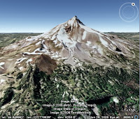
Here are a few images that I was able to create using this process. Click each one to make it larger. Truth be told, I retouched each a bit (Brightness/Contrast) in Adobe Fireworks. From top to bottom, they are Swiss Alps; Mounument Valley, AZ and Big Sur, California.

Monday, July 28, 2008

Collaborating on Maps

Did you know that you can collaborate with others as you create a custom online map? Google Earth Outreach offers a tutorial that describes exactly how to do this in Google Maps. Once you and your colleagues have created your map, you can export it to KML and view it in Google Earth.

My local mountain bike club is using this feature set to create a list of trailwork projects. Our collaborative map will show the location of needed trailwork and potential new trails we hope to build. I hope to share this soon with everyone, including the Forest Service.

Monday, July 21, 2008

Geotagging on Linux

Fellow Googler and GPS geek extraordinaire Marc Merlin has created a guide to geotagging photos and GPS tracks using gps visualizer and gpsPhoto. This is a technical, hands-on guide that describes how to create very compelling geo mashups.

Whether or not you follow this guide, it is worth checking out Marc's presentation. He cleverly uses Google Maps, photos and GPS data to describe details of a multiday trip on Northern California's Lost Coast Trail (one of my favorite places).

Wednesday, July 09, 2008

Posting to the YouTube Layer

Frank Taylor of Google Earth Blog reminds me to mention how to post to the YouTube layer.

It works like this: when you post a video on YouTube, you can assign a location to your video (see Date and Maps Options). You also need to allow the YouTube video to be embedded in other web pages (see Sharing Options).

Once you have done this, the video becomes part of the YouTube layer in Google Earth.

Tuesday, July 08, 2008

Embedding Videos

If you used Google Earth enough, you've probably seen videos embedded in placemark balloons. But did you know how ridiculously easy it is to create these youself? Try this one minute tutorial:
  1. Go to YouTube and find your favorite video.
  2. In the Embed field (right of the video), select and copy the code.
  3. In Google Earth, navigate to the appropriate location and create a placemark. For example, for a video filmed in a New York neighborhood, create your placemark in that location.
  4. In the Edit Placemark dialog box, in the Description tab and field, paste the YouTube code. Click OK.
Done. Click the placemark to view your video. Of course you can now share and publish this placemark.

Wednesday, July 02, 2008

Geo Photo Tools

Here are some third party tools that enable you to automatically assign locations to your photos in Google Earth:

KML2KML - Windows only. The Photo Track feature of this application allows you to arrange photos on track according to GeoEXIF or GPS data. Check out this example.

gpicsync - This enables you to automatically geocode pictures from your camera and GPS tracks.

HoudahGeo - Mac OS only. Assign photos to locations. You can also export you data to EXIF/XMP.

Additional tools - Robert Lipe has collected this list of photo geo taggers.

Of course you can manually assign locations to photos in Picasa and publish them to Earth. Learn more.

Monday, June 30, 2008

Tour Tips

When you create a tour, try the following tips to create a great tour experience:

Before you record your tour or present it to others, run the tour on a loop again and again. This will cache the imagery and provide a higher quality tour.

Consider how fast you want the tour to proceed. Is the Earth imagery more important or does content that appears in placemark balloons need more emphasis? You can set how fast the tour plays, how fast it flies to each destination and how long the tour pauses at each placemark. Learn more.

Set your tour to follow an invisible path (see this earlier posting).

Friday, June 27, 2008

Emergencies in Google Earth and Maps

Public agencies and NGOs have learned to use Google Earth/Maps and KML to create incredibly useful presentations about disasters, even as these emergencies are unfolding. Here are some examples:

Northern California fires - Created by the California Governor's office of Emergency Management, this map has been invaluable for those of us who live near these areas.

Myanmar Cyclone - This KML shows the impact of the original Nargis storm, including the enormous scale of flooding caused by the disaster.

USGS Earthquake Monitoring - This depicts significant earthquake activity in the past seven days. From the placemark balloons, you can also access historical earthquake information.

Google publishes great related information that you can access in the Layers panel, such as the Weather, Gallery > Volcanoes/Nasa and Gallery > Wikipedia. I find these visual depictions to be so much more meaningful that media reports that merely talk about the impact of these disasters. With dynamic mapping tools, you can see exactly where the emergencies occurred and what regions are affected.

Tuesday, June 24, 2008

KML Samples in Maps

Curious how KML elements appear in Google Maps? Take a look at this sample file. Check any item to display it or click a link to zoom in. Google Maps supports a subset of KML features, as described in the KML documentation. Of course, you can view a KML sample in Earth as well.

Although I have not tried it, this site claims to preview your KML on Google Maps, which is certainly easier than tweaking you code, uploading your KML to a server and reloading it with each change you make.

Thursday, June 19, 2008

All About Context

Michael Jones discusses geographical context and Google's objectives in this fascinating presentation:


Tuesday, June 17, 2008

Preserving with Google Earth

On Friday, I presented to the Northern Region Council of Land Trusts in Fortuna, California. The subject was using Google Earth and Maps as tools for land conservation. The work of local land trusts is very important, as they work cooperatively with the entire community to preserve open space, create trails and simply make our communities better places to live. Land trusts often operate on a shoestring budgets and rely on the honorable efforts of volunteers.

I've long thought that Google Earth and Maps represent great tools for these organizations. With little technical know-how or money, they can use these products to mark locations and parcels important to conservation campaigns and share them with the public. It can be difficult for land trusts to convince the public or government that a particular area is worth preserving, particularly if the land in question is in an obscure or remote location. Google Earth removes these limitations; you can fly people to any location and show off its unique qualities. Once again, it is all about geographical context.

Wednesday, June 11, 2008

Outreach Showcase

Want to see some very inspiring, imaginative presentations in Google Earth? Look no further than the Google Earth Outreach Showcase. The KML on these pages are created by people who are literally trying to change the world by raising awareness of important global and local issues.

Close to my home, I am particularly fond of the California's Marine Protected Areas KML, which makes clever use of polylines, image overlays and attractive HTML placemark balloons to describe the beauty and importance of these coastal areas within a geographical context.

Monday, June 09, 2008

Navigating in Version 4.3

I am not sure how I managed to forget to mention this, but in April, I created a video that covers some the new navigation features in Version 4.3.

Thursday, June 05, 2008

Google Earth API

The Google Earth browser Plug-in supports a JavaScript API that allows you to manipulate camera angles, open balloons, add 3D models, draw KML, toggle to Sky mode and much more.

To see first hand what it can do and view some sample code, check out this sample page. For beta documentation, take a look at the developer guide. For additional help, visit the Google Earth Plug-in help group.

Tuesday, June 03, 2008

Labels and Layers

As in real life, navigating in Google Earth is easier if you have some physical reference points. Some of these are obvious and popular, such as the road, borders and labels layers. In addition, you can orient yourself by using Places of Interest layers. Within this folder, I find the following very useful:

Geographic Features - I spend a lot of time hiking and biking and this folder shows great information (bodies of water, mountain peaks, etc.) in areas that have fewer roads. Plus, you can check out historic seismic activity around the world, courtesy of the USGS.

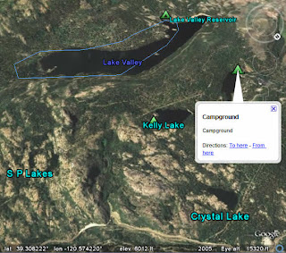
Parks and Recreation Areas - Again, my bias towards the great outdoors is in effect here. But this information is fantastic. Camping spots, trail routes, wildlife refuges, ranger stations and more. The USFS boundaries can help you work with traditional topographical maps to find your way.

Of course, you may need to zoom in a bit to see some of these points of interest in the 3D viewer.

Thursday, May 29, 2008

Bring Google Earth to Your Website

Yesterday, Google released the Google Earth API (news). You can use this API to embed Google Earth and geographic content in your web pages. What really excites me is that you can also add a Google Earth view to your existing Google Maps API-enabled map by just adding small snippets of code.

To see what I mean, see below. Notice the Earth button:


See an example at Housingmaps.com.

Additionally, you can also display your KML-based content in this 3D view. To see this in action, visit Virgil Zetterlind's tool that allows you to display your KML in an embedded Google Earth view. Below, I display a KML depiction of one of my favorite mountain bike rides:

div>

Tuesday, May 27, 2008

Determining Elevation

Before this weekend, I spent time trying to determine if my Memorial Day weekend mountain bike trip to Tahoe would be a bust or not. Word is that snow remains on trails above 7000'. Yet we had planned rides at or near that elevation.

To determine if we would be skunked on our ride, I launched Google Earth and navigated to the area. Simply by mousing over particular locations, I could view exact elevations at the bottom of the 3D viewer (see image).

In the end, we aborted our Tahoe trip and stuck to lower elevation rides. This was unfortunate, but certainly not as bad as wasting hours of driving only to find a wall of snow across our favorite trails.

Tuesday, May 20, 2008

Catching Air

OK, here is a different kind of tip:

Tuesday, May 06, 2008

Geo Education

Google has launched a Geo Education site for educators who are hoping to include Google Earth, Maps, Sky or SketchUp as part of lesson plans. There are some great classroom ideas on how to use these products to help your students understand geography, geology, history and more.

If you are new to these products, check out the getting started guides. You can also connect with other educators in the Google for Educators discussion group.

Friday, May 02, 2008

Movie Maker Tips

Google Earth Pro users may be happy to learn that the user guide has a section devoted to movie maker tips. By following these suggestions, you can make outstanding movies with much less hassle.

Perhaps the most important thing to do before recording is to maximize the performance of your computer. You can do this by closing all other applications, unchecking all layers in Google Earth except terrain (and 3D buildings if necessary) and downloading the latest video driver for your computer. You can also try adjusting texture quality as this can affect both performance and visual quality of your video.

If you are still have questions, try the Google Earth Pro group.

Monday, April 21, 2008

Navigating on the Ground

With Google Earth version 4.3 comes the ability to navigate on ground level. To do this, zoom into your favorite location so that your line of sight is parallel to the surface of the earth (you can do this using the Zoom slider). Navigate around by using the arrow keys on your keyboard. Press Alt + arrow keys to move slower.

Note that when you encounter a change in ground elevation (such as a hill or mountain), your viewpoint ascends and descends these objects, as if you were climbing over them. Google Earth returns you to your original elevation once you have cleared them.

Of course, you can stop anywhere and look around using the Look joystick.

Friday, April 18, 2008

Does Whatever a Spider Can

When I was a kid, I was a Marvel comic book fanatic, but no superhero held my fascination like Spiderman. I horded Spidey issues. I drew pictures of him. My family has pictures of me posing as Spiderman as I pretended to walk on walls and swing from building to building.

30+ years later, my fantasy has become realized in Google Earth 4.3. Few have noticed this new feature yet, but you can swoop to the top or sides of 3D buildings, then jump from building to building ala my favorite superhero. To do this, right click (CTRL + click on the Mac) on the building and drag the mouse. You can swoop from building to building by doing the same. Learn more in the user guide.

You can also view a 3D building from different perspectives. To do this, click the middle mouse button (Shift + left mouse if your mouse does not have a middle button).

Wednesday, April 16, 2008

Version 4.3 Released

The latest version of Google Earth is available for download. Read all about the new features on Google Earth Blog, OgleEarth and Lat Long.

Personally, I am stoked about this release for aesthetic reasons (hey, eye candy is important). With the sun and 3D building features, the world looks so much more realistic and beautiful in this version. You may have also noticed that the atmospheric rendering is improved, making views around the world quite lifelike.

Previously an easter egg, the flight simulator now is available by default in the Tools menu. You can fly to some gorgeous views by using the flight simulator and sun feature. Try setting the sun to appear on the horizon, at dawn or sunset, and fly over the Swiss Alps. I should also mention that I've created a new section of the user guide devoted to the flight simulator feature.

Thursday, April 10, 2008

Setting Views

As I mentioned in an earlier post, you can automatically assign a particular view to a placemark. But you can also set this manually when you create or edit a placemark.

In the New or Edit Placemark dialog box, click the View tab and change any of the following:

Latitude and Longitude - Coordinates for the placemark
Range - Distance from the placemark to the viewing position.
Heading - The orientation of the viewpoint relative to north.
Tilt - Angle between the viewpoint and the surface of the earth.

Click OK. When you or anyone else double clicks this placemark, the 3D viewer brings you to this specific view. Note that the settings above correspond to KML's LookAt element.

Tuesday, April 08, 2008

Approximate Addresses in Google Earth Pro

If you are a Google Earth Pro user, you can quickly obtain the approximate address for many locations. In the geeky GIS world, we call this "reverse geocoding". This means that you visually pick location and Google Earth Pro provides you its best guess for an address for this place.

Give it a try. Just navigate to the appropriate place, press down the Ctrl key and right click (Ctrl + click on the Mac) a location.

Thursday, April 03, 2008

Dynamic KML

In this video, Googler Mano Marks demonstrates techniques for using view based refresh (VBR), and other dynamic querying techniques in KML.


Friday, March 21, 2008

Dynamic Layers Content

Occasional users of Google Earth may not be aware that content available in the Layers panel is frequently changed. Entirely new layers are often added and existing content is expanded and updated. It is a great idea to explore the Layers panel to see what is new.

As someone on the Google Earth team, even I have a tough time keeping up with it all. Lately, I find myself drawn to the following layers:

YouTube - (Gallery) Poke around in this layer and you can find some real gems. My favorites videos depict something that relates to a location. For example, near my hometown, someone posted a video of a driving tour of Christmas light displays around town. My kids loved this.

Weather - For the ultimate in dynamic content, enable this layer. Google recently began publishing weather for many additional locations. View current cloud cover, precipitation and forecasts. And don't forget to play with the clouds.

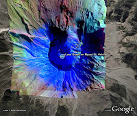
NASA Satellite Imagery - (Gallery > NASA) There is some fantastic alternate imagery of the planet available in this layer. Many of these images tell important stories about human and natural events around the globe, such as floods, dust storms, deep ocean whirlpools and more. Check out the photograph of Mount Saint Helens.

GigaPan - (Gallery) Again, this layer shows outstanding local imagery of fascinating locations. The imagery from Yellowstone National Park is a great example.

Tuesday, March 18, 2008

Pre-Hiking Reconnaissance

One of my favorite uses of Google Earth is to plan and scope out upcoming backcountry trips. Currently, I am plotting a overnight camping trip on the Pacific Crest Trail (PCT) near Mount Shasta in California. There are a number of ways to do this:

Navigate to the area - Tilt and check out the terrain. This will give you a sense of what you will find on your trip, including natural features, lakes, etc.

Display existing trails - (Layers panel > Gallery > Trimble Outdoors Trips) This layer has some excellent information about trails and the PCT in particular. It includes tracks, trailheads, distances, landmarks, pictures and more.

Import a map as an image overlay - I pulled in a USFS map for trails in the area, which included additional information about distances and landmarks.

Display names for natural features - (Layers Panel > Places of Interest > Geographic Features) These names are extremely helpful because they often correspond to topographical maps. Note that these names do not appear until you zoom in a bit.

Wednesday, March 12, 2008

Real Estate and Google Earth

Over the weekend, a friend and occasional user of Google Earth asked me about how he could use the software with his real estate business. There are many options, ranging from the simple to the elaborate:

Create placemarks of properties - Once you create and share placemarks, clients can virtually visit listings, read your descriptions, view videos and more.

Create polygons showing parcel boundaries - Again, this gives clients the opportunity to see exactly what it is you have to offer. Learn more.

Import your existing GIS data into Google Earth - Google Earth Pro can ingest your GIS data and allow you to publish much of this information to both Google Earth and Maps. As a large scale example, the City of Portland has published data for parcels, zoning, crime, school districts and more.

Create, import or place SketchUp 3D models - Using Google SketchUp, you can create or import simple or complex models of properties and place them in Google Earth. The 3D Warehouse has models ready for you to start with.

Monday, March 03, 2008

Extend to Ground

You can create lines that appear between a placemark and the ground. Of course, this line only appears if the placemark is elevated above the Earth.

To do this, first create a placemark. In the New Placemark dialog box, enter an altitude value above zero or use the slider and check Extend to ground.

Polygons, lines and paths can also extend to the ground. With these items, Google Earth draws a geometric shape from the earth's surface to the item.

Wednesday, February 27, 2008

Flight Plans

As I plan my summer vacation, I've begun to wonder where my flights might put me as I fly to my destinations. Will I fly over the Grand Canyon? Yosemite? Nebraska? Assuming that my flights proceed in a more a less direct line, I could make a good guess using Google Earth.

Using the measure tool, I drew a line between destination points, which allowed me to see the approximate path of the flight and of course the distance. You can create multiple destinations using the path tool, but you won't see distance.

It is neat to see where your flight might go. For example, a straight line flight between Seattle and Tokyo will take you over the Aleutian Islands in Alaska. This seems counterintuitive until you look at the globe as a three dimensional sphere as it is displayed in Google Earth.

Monday, February 25, 2008

KML Video

The "Quick and Dirty KML Creation" presentation is now available on YouTube. Check it out.

Friday, February 22, 2008

Geo Data on the Web

If you are a Google Earth user, you can view all kinds of fascinating free geo data available on the web. For example, this morning, I went exploring on the US Forest Service website and poked around the FSGeodata Clearinghouse. This collection offers interesting vector and raster-based mapping data for USFS lands in the United States, such as topographical maps. Some of the data in this site is KML-based.

The WMS feature of Google Earth also allows you to access publicly available geo data and import it seamlessly into Google Earth as an image overlay. Google Earth Pro users can import GIS data directly into the application.

Wednesday, February 20, 2008

KML Workshop

Yesterday, I attended a public workshop here at the Googleplex entitled "Quick & Dirty KML Creation". Pamela Fox and Mano Marks showed us "how to use tools within Google Maps and Google Earth to create, import, and edit KML." This was part of the Google Geo Developer Conference series.

The presenters described using Google Earth and MyMaps feature of Google Maps to create, edit, import and export KML. They also discussed the new KML spreadsheet tool that allows you to create placemarks using entries in a Google spreadsheet, the Google Maps API and other topics.

One participant asked an great question: when should you author content in Google Earth as opposed to editing the KML directly? Generally speaking, it depends :-) For example, editing in the Google Earth graphical user interface (GUI) is optimal when you are creating a specific view, or want to visually choose colors and icons. But editing the KML itself is best when you are creating single shared styles for multiple items, or add in elements such as time animation that the GUI interface doesn't allow you to edit.

This workshop should be available on YouTube soon. I'll post a link for it as soon as possible.

Wednesday, February 13, 2008

GPS Tracking on the Go

Google Earth Plus, Pro and EC allow you to track your movements in real time via GPS. For example, you can view a live GPS track of your drive in a car on a laptop as you travel. To do this, you'll need a GPS device connected to your computer.

After you complete your trek, you can view an animation of the journey using the time slider.