Monday, February 26, 2007

KML Styles

As with external CSS and HTML files, you can define styles in one KML file that you reference in other KML files. For example, you can create a file called mystyles.kml that contains the following:

<Document>
<Style id="foo">
... style description
</Style>
</Document>

Any other KML file you create can call the following:

<styleUrl>http://foo.com/mystyles.kml#foo</styleUrl>

For a detailed description of how to use style tags, view the KML reference. Learn more about KML.

Thursday, February 22, 2007

Excellent GPS and Photos Writeup

Frequent readers of this blog know that I am a trail and GPS enthusiast. If you are interested in combining photography and GPS data for compelling presentations in Google Earth, be sure to check out Life of a Geolocated Blog Post.

This excellent article describes exactly how to combine photography of various points in an area (say a hiking trail) and GPS tracking information to create a depiction of your trip in Google Earth or Google Maps. See some examples of this technique in action (be sure to click the Google Earth/Maps geotag links at the end of the articles). Very cool, eh?

You can also view my previous posts on this subject:

Tuesday, February 20, 2007

Quick 3D Objects in Google Earth

Did you know that you can easily create simple 3D polygon shapes in Google Earth? To do this:

Draw a polygon shape. In the New Polygon dialog box, click the Altitude tab. Slide the slider from Ground toward Space. This elevates the polygon. Elevate the shape to the appropriate height. Check Extend sides to ground. The polygon is now a 3D object. Click OK to save your new 3D polygon.

Of course, there are other 3D objects that you can place into Google Earth, including Google SketchUp models. Learn more about placing other 3D objects.

Wednesday, February 14, 2007

New Movie Making Tutorial

Today, I published a new tutorial that describes how you can create movies in Google Earth Pro and EC. Please take a look and pass along any comments you may have.

As the tutorial mentions, "You can use the Movie Maker feature to record 3D viewer imagery and save the recording as a movie file. You can make a movie that follows the camera viewpoint to and from multiple locations. You can either set the feature to record your interactions with the 3D viewer in real-time, or you can set up a tour and record the entire tour without interruption. Once you finish recording and have saved your movie file, you can make the file available on a web site, use it in a presentation, or send it via email."

You learn more about all of Google Earth's movie making capabilities in the user guide. There are other tutorials you can follow as well.

Monday, February 12, 2007

Great KML

First, I posted about great blogs, now it is great KML. Do you know of exemplary KML that the world should know about? Add to this list by using the comment feature of this blog (see below).

Click any of the following to view these examples in Google Earth:

Friday, February 09, 2007

Unclutter Your View

Google Earth can display a LOT of great information in the 3D viewer. Roads, placemarks, borders, parks, 3D buildings, train stations and much, much more. In fact, your view of an area can be so full of information that things can become cluttered and difficult to visually parse. Fortunately, Google Earth allows you to hide or display information. There are two ways to do this:

Places Panel - You can hide or display individual placemarks or entire folders by checking or unchecking these in the Places panel. Of course, you can also hide all placemark information by unchecking the top level folder (My Places). Learn more about using placemarks.

Layers Panel - Similarly, you can hide entire categories of information by checking or unchecking items and folders in the Layers panel. For example, if you want to view the natural terrain of an area, but not street information, uncheck Roads. Learn more about layers.

Wednesday, February 07, 2007

Other Blogs

This is not the only game in town. Google Earth is the focus of many other outstanding blogs that describe features, news and fascinating implementations of this technology.

Some of these blogs include:
Occasionally, the official Google blog has some great Earth-related posts (like this one showing me hopping on my mountain bike :-). Do you know of any additional Google Earth-themed blogs that deserve mention? Let everyone know by using the comment feature below.

Friday, February 02, 2007

Brandeis Visit

Yesterday, I made a presentation to faculty and students at my alma mater Brandeis University in Waltham, MA. The topics were Google Earth, Maps, KML and technical writing at Google. As expected, the audience provided a great set of questions about the technologies I described:

Question: Does Google offer educational site licenses of Google Earth Pro that would allow users to create movies?
Absolutely. Call 1-866-755-2582 or visit earth.google.com.

Question: How can I view, track, and save changes in images of areas in Google Earth over time?
Currently, Google does not publish dates of imagery used in the product. However, if you have acquired imagery from other sources, you can place them in the 3D viewer using the image overlay feature.

Question: How is Google Earth different than traditional CD-ROM based mapping software like DeLorme TopoUSA and National Geographic's TOPO?
Google Earth creates a realistic 3D depiction of the world using satellite images, terrain data and various vector datasets.

Question: Can Google Earth be used to depict a tree survey in a local neighborhood?
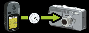
Sure. You could approach this project by using a GPS device and marking the location of each tree. Note the waypoint name and jot down the species. Upload the GPS data to Google Earth Pro or Plus, create a set of placemarks that show the location of the trees, place these placemarks in a folder and share these placemarks with others. Of course you could get fancy by creating 3D models of trees (see the Google 3D warehouse for examples).

Question: Does anyone edit the placemarks posted in the Google Earth community?
The Google Earth Community layer (Layers panel) depicts all placemarks currently posted in the Google Earth Community. However, the Google Earth Community showcase layer shows the best examples of postings from these boards.

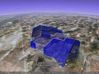
Question: Where can I learn more about the James Reserve KML?
During the presentation, I displayed a great use of KML and Google Earth by Sean Askay. This KML was created as part of Sean's masters thesis at UC Riverside and addressed ecological conditions in the James Reserve in Southern California. Read more about his thesis and KML.