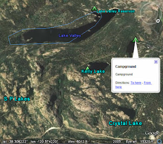
 As in real life, navigating in Google Earth is easier if you have some physical reference points. Some of these are obvious and popular, such as the road, borders and labels layers. In addition, you can orient yourself by using Places of Interest layers. Within this folder, I find the following very useful:
Geographic Features - I spend a lot of time hiking and biking and this folder shows great information (bodies of water, mountain peaks, etc.) in areas that have fewer roads. Plus, you can check out historic seismic activity around the world, courtesy of the USGS.
Parks and Recreation Areas - Again, my bias towards the great outdoors is in effect here. But this information is fantastic. Camping spots, trail routes, wildlife refuges, ranger stations and more. The USFS boundaries can help you work with traditional topographical maps to find your way.
Of course, you may need to zoom in a bit to see some of these points of interest in the 3D viewer.
1 comment:
Do you know of a way to export parks and recreation layers?
Post a Comment