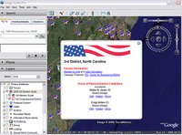
 If you are in the United States, you probably know all about next week's elections. Google Earth can help you participate in this democratic process in a number of ways:
Learn where the elections are - Google Earth offers a layer (2006 Election Guide) that shows you complete election information for races in congressional districts around the United States. This layer also shows the geographical border of each district. Read more here.
Register yourself - Using the aforementioned layer, you can even register to vote! See the link at the top of each placemark balloon.
Understand the candidates - Each placemark in this election guide layer includes links to news, images and other websites about the candidates.
To learn more about using layers, see the user guide or check out this earlier blog post.
No comments:
Post a Comment